
Today’s Wonder of the Day was inspired by Justine from Union City, CA. Justine Wonders, “How do we navigate using stars?” Thanks for WONDERing with us, Justine!
Let your imagination take you back several hundred years to a time when grand ships set off across the oceans of the world in search of new lands, resources, and adventure. Can you see yourself as the captain of a ship like Christopher Columbus?
Although it might sound exciting, there are a few things you should remember: you don't have the Internet. Google is hundreds of years in the future. There are no Global Positioning System (GPS) satellites overhead. Even the rudimentary paper maps you possess are not much more than guesses about what lies ahead.
This might not seem like an overwhelming problem while you're in port. However, once you set sail, you'll soon find that you're surrounded by miles and miles of nothing but water. Your view in every direction is remarkably similar. There are no landmarks to tell you where you are or where you're going. How can you be sure you're on track?
While there might not be any LANDmarks, there are some guides that ancient mariners relied upon to guide them safely across the seas. All you have to do is look up into the sky. That's right! Sailors long ago relied upon the Sun, the Moon, and many other heavenly bodies, such as stars and planets, to guide the way.
If you've ever stared up into the night sky, searching for shooting stars or popular constellations, you've probably noticed that the positions of the Sun, the Moon, and the stars change regularly. It can be challenging to find these items night after night as they shift positions and move across the night sky. How then did ancient sailors ever use these things to guide their movements?
At any particular point in time, every celestial body is directly above a particular point on Earth. We call this point its geographical position. Someone standing at the geographical position would see the celestial body directly overhead.
However, the geographical position of most celestial bodies changes constantly, because Earth rotates on its axis and revolves around the Sun. There are two points on Earth, however, that don't constantly change position relative to the sky above them: the North Pole and South Pole.
Fortunately for ancient sailors, there's a star whose geographical position is very close to the North Pole: Polaris, more commonly known as the North Star. If you keep your eye on Polaris, you'll notice that all the other stars appear to revolve slowly around it.
If a sailor was sailing north, he would notice Polaris increasing in height in the sky. If Polaris was decreasing in height, then a sailor would know he was headed south. Sailors eventually learned that measuring the angle of Polaris in the sky would give them their approximate latitude.
If you're familiar with geography, you know that every point on Earth can be pinpointed by an exact latitude and longitude. To fix their position exactly, sailors would thus need to rely upon more than just Polaris.
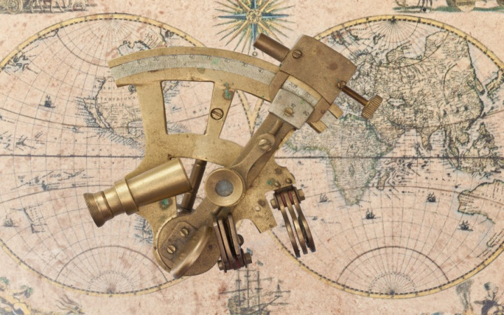
Ancient astronomers developed complex star charts that showed the various positions of celestial bodies at different times. Using basic tools, such as a clock, and advanced tools, such as a sextant, ancient sailors were able to estimate their position with some degree of accuracy by plotting the position and angle of two or three celestial bodies and then using some basic math.
A sextant is an old tool navigators used to measure the angle between objects in the sky and the horizon. Using these angles for different celestial bodies and basic mathematics, navigators could determine where they would have to be to see those celestial bodies at their observed angles at that time. This calculation would reveal their approximate location. The more readings they took with different celestial bodies, the more accurate they could be in determining their exact location.
So is celestial navigation a lost art? To those of us on Earth spoiled by Google and GPS receivers, that answer may be yes. But there's one area where it's still an advanced science that's used every day: space exploration. NASA scientists use advanced celestial navigation to guide everything in outer space, from the Hubble Space Telescope to the Mars Rover.