
Today’s Wonder of the Day was inspired by Kendell. Kendell Wonders, “Who decides the shapes of the states?” Thanks for WONDERing with us, Kendell!
Do you love maps? Here in Wonderopolis, we have a room that's filled with nothing but maps. We spend hours just looking at maps and dreaming of visiting every state, country, planet, and imaginary land that exists anywhere and everywhere!
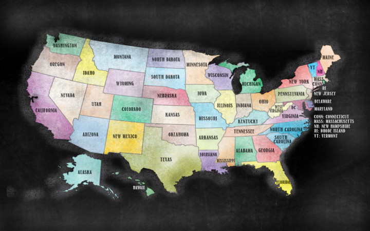
If you look at a map of the United States, it's easy to identify certain states that have unique shapes. For example, the states of Texas and Florida have interesting shapes that just about everyone recognizes at first glance.
However, there are also many states that have similar shapes and aren't easy to identify by themselves unless you see them in context on the map of the entire United States. For example, it can be difficult to distinguish Wyoming from Colorado and North Dakota from South Dakota unless you see them in context, because they have such similar shapes.
Curious Wonder Friends from all over the United States have WONDERed for some time about how the states got their shapes. Although there's no single, simple answer to that question, let's investigate some of the factors that shaped the way the states look.
There are 50 states in the United States, and that means there are about 50 unique stories that explain how each state got its shape. The person who has probably researched this topic more than any other is Mark Stein, of the book How the States Got Their Shapes.
According to Stein, four of the biggest influences that dictated the shapes of the states were the American Revolution, the construction of railroads, the 1808 proposal for the Erie Canal, and the political controversies over the issue of slavery. The American Revolution, for example, helped to define the shapes of the original 13 colonies that became the New England states.
The shapes of the earliest states were often defined by natural geographic boundaries, such as rivers. New Hampshire and Vermont are separated by the Connecticut River. Similar boundaries exist elsewhere in the U.S. California and Arizona are separated by the Colorado River. Likewise, the Ohio River defines the southern boundary of Indiana.
If you look at a map of the original 13 colonies, you'll notice that they vary wildly in shape and size. This did not please Thomas Jefferson. Being a big fan of equality, he suggested that Congress create future states equal in size based upon latitude and longitude coordinates.
Specifically, he thought that states in the new Northwest Territory (between the Ohio and Mississippi Rivers) should be approximately two degrees of latitude and four degrees of longitude (or about 138 miles high by about 276 miles wide). Although Congress didn't use Jefferson's recommendation in the Northwest Territory, it did use latitude and longitude to create states similar in shape and size in the western U.S.
For example, Washington, Oregon, Colorado, Wyoming, North Dakota, and South Dakota are all about seven degrees of longitude (or about 483 miles wide). Likewise, Kansas, Nebraska, North Dakota, and South Dakota are all about three degrees of latitude (or about 207 miles tall).
With the construction of cross-country railroads, the shapes of states didn't depend as much on the natural routes of rivers. Instead, railroad routes began to shape where one state ended and another began. The construction of the Erie Canal also influenced the shapes of states in the regions it traversed.
The issue of slavery also helped to mold the shapes of the states in the territory included in the Louisiana Purchase of 1803. The Missouri Compromise of 1818 solidified the practice of basing state boundaries in the region on where slavery was legal. It allowed slavery in states with northern borders below 36 degrees, 30 minutes north latitude, with the exception of Missouri.
Finally, two large states bear a special mention on this subject: California and Texas. Unlike other states, California and Texas determined their own borders. Other states and Congress were basically forced to accept these states' proposed boundaries, because of the political power they wielded and the fear that they might secede from the United States in the event of a territorial dispute.