
Today’s Wonder of the Day was inspired by Jaden. Jaden Wonders, “Why is North Korea closed off ?” Thanks for WONDERing with us, Jaden!
Have you ever spent much time studying a globe? Flat maps are great, but there's nothing quite like seeing Earth as it really is. Globes give you a perspective on where things are that you usually can't get from a flat map.
As you study a globe, you'll notice lines of latitude that circle the Earth and extend north and south of the equator. There are also lines of longitude that run the other way, east and west of the prime meridian.
You can search all day long, but you'll never see any of these lines in person. Why? They're imaginary! They're just a convenient way to pinpoint places and navigate around the planet.
In fact, the very spot where you're sitting right now has a set of coordinates that corresponds to the exact latitude and longitude of your location. If you own a Global Positioning System (GPS) receiver or a smartphone with a GPS chip, you can find out and tell others exactly where you are!
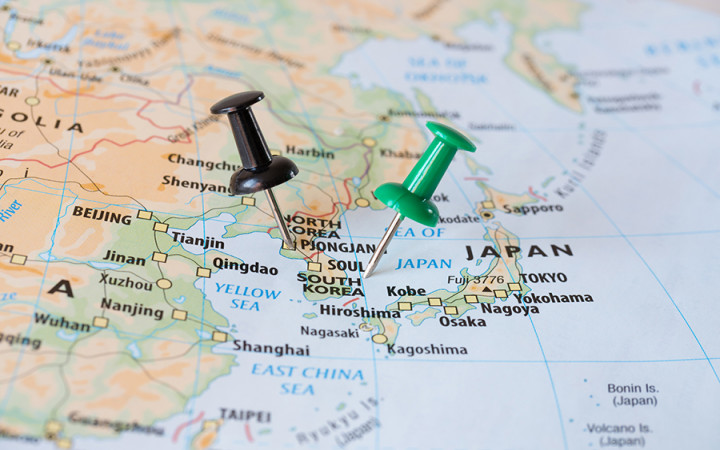
In addition to the equator, there's another line of latitude that many people know by name: the 38th parallel. Specifically, it's the 38th parallel north that people know as the approximate boundary between the Democratic People's Republic of Korea (more commonly known as North Korea) and the Republic of Korea (more commonly known as South Korea).
Many people assume that the 38th parallel separates North and South Korea as a result of the Korean War. In reality, the boundary existed before the Korean War and dates back to the end of World War II.
As World War II came to an end, the Allies had to decide how to handle Japan's colonies, which included Korea. At that time, Korea was one entity that occupied the whole Korean peninsula.
Troops from the Soviet Union had already arrived in the northern part of Korea. The tensions between the United States and the Soviet Union that would define the Cold War between the countries had already started.
The United States knew it would be a while before it could get troops to Korea, and it worried that the Soviet Union would take advantage of its absence by taking over all of Korea. U.S. Colonels Charles Bonesteel and Dean Rusk met on August 10, 1945, to develop a plan to divide Korea into two zones of occupation.
Using a National Geographic map, they noticed that the 38th parallel roughly divided Korea in half. They suggested using it as a boundary, since it would keep Seoul, the capital, in the southern half to be controlled by the U.S. To their surprise, the Soviets agreed.
Unfortunately, peace on the Korean peninsula would not last long. On June 25, 1950, over 75,000 North Korean troops crossed the 38th parallel and invaded South Korea. The U.S. quickly came to the aid of South Korea and the Korean War began as the first military action of the Cold War.
Although the military action played out all along the 38th parallel, the war was really a battle between the forces of communism on one side (North Korea backed by the Soviet Union and China) and capitalism on the other (South Korea backed by the United States). Neither side could gain a decisive advantage and casualties piled up with relatively little change in territory.
Eventually, an armistice signed in July 1953 brought the Korean War to an end. In total, about five million people died in the Korean War, including many civilians. The cease-fire line roughly followed the 38th parallel with only minor changes, and the country remains divided along that line still today.
A demilitarized zone (DMZ) was created along the boundary by pulling back troops two kilometers on each side. The DMZ stretches about 150 miles across the width of the peninsula and remains one of the most hostile borders in the world even today.

